How to Read Blue Lines on a Map
Learn how to read blue lines on a map by tracing their connections, comparing local detail and interpreting the landforms that shape the drainage network.
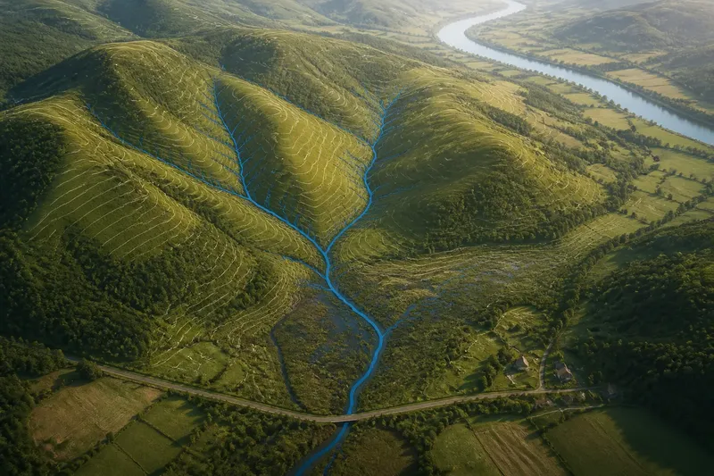
The common mistake when reading blue lines on a map is to treat each as an isolated feature. That can hide how a small channel connects to a wetland, tributary or main river. To read blue lines on a map well, trace the network and ask what the pattern says about how water moves through the landscape.
Trace the drainage network
Begin at the line’s visible start and follow it downstream. Look for tributaries joining it, bends that follow a valley, and a connection to a larger river, lake or wetland. These links place the mark within a drainage network rather than leaving it as an unexplained stroke.
On a paper map, use a pencil to follow the line without obscuring nearby details. On a phone or computer, zoom in and pan along the route, keeping the same channel in view. At junctions, check which lines meet and where the combined channel continues. A junction can reveal the direction of the network, but it does not by itself show current flow.
Notice where the mapped network stops. A line may end at a road, settlement edge or map boundary, or it may fade into a wetland. That ending can reflect how the feature is represented, not necessarily where water ceases to move. Record what the map shows without treating an unexplained endpoint as a source.
Read the landform pattern
Contour lines and shaded relief help explain why channels follow particular routes. Contours that form V-shapes pointing uphill commonly mark a valley crossing; the channel lies in the lower ground. Where several small valleys converge, their channels may join into a larger river.
Compare the drainage pattern with ridges and slopes. Channels generally gather water from the land that falls towards them, while higher ground separates neighbouring drainage areas. A broad, flat wetland can make those divides harder to read, so use several nearby contours rather than relying on one bend or symbol.
Built features can interrupt the visible pattern. Roads may cross channels through culverts, and developed areas can reshape or cover natural drainage. If a blue line appears to stop at a road, look for a continuation on the other side and check whether the map depicts a bridge, culvert or other crossing.
Distinguish network patterns
The shape of a network offers clues about the terrain, but it is not a substitute for the map’s symbol key. A branching pattern may show tributaries joining a main channel. A wetland may appear as a shaded area with several channels running through it. In a managed landscape, straight sections and regular junctions may indicate drainage works or canals.
Look for these relationships rather than classifying a feature from appearance alone:
- Branching lines: Follow the smaller channels towards their junctions with a larger stream or river. If the branches converge, describe them as a connected network; if the map’s line style is unclear, check the layer key before naming their type.
- Parallel channels: Check whether the lines follow field boundaries or run in unusually straight courses. If the map identifies drains or canals, use that label; otherwise, leave their purpose uncertain and compare with another source.
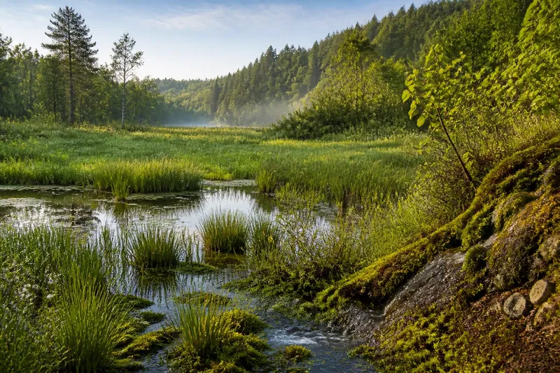
- Lines within shaded ground: Check whether the map marks marsh, wetland or floodplain nearby. If the channel crosses that area, interpret it as part of a water-rich landscape; if the shading has no key, avoid assigning a wetland category from colour alone.
- Gaps at roads: Look for a crossing symbol or continuation beyond the road. If the line resumes on the other side, treat the gap as a possible mapped crossing; if it does not, check a more detailed local map before concluding that the channel ends there.
- Several lines meeting: Trace each branch and inspect the contours around the junction. If the ground falls towards a shared valley, describe the lines as connected drainage; if the terrain is flat or hidden, keep the direction uncertain.
- A line ending at the map edge: Check the adjoining sheet or pan beyond the boundary. If the channel continues there, record the map boundary as the reason for the apparent stop; if no adjoining coverage is available, leave the endpoint unresolved.
Work through a map
Say you are looking at an invented map excerpt with three blue lines above a shaded hollow. The map key labels the lines as streams, but it does not identify which one is the main channel. You trace the two shorter lines downhill: both meet the third, which continues through the hollow towards a named river. Contours form uphill-pointing V-shapes around the smaller lines and open into a broader valley at the junction. The resulting reading is that the map depicts two tributaries joining a channel in a low area; the map does not establish whether those streams are flowing today.
Use the same sequence when a network looks unclear: trace connections first, read contours around junctions, then check whether wetlands, roads or built land explain changes in the pattern. If the map ends before the network does, use adjoining coverage rather than guessing.
Questions about blue lines?
How can I tell which way a stream flows?
Read the contour pattern: a channel generally runs downhill, and contour V-shapes point uphill where they cross valleys. If the contours are absent or too widely spaced to clarify the route, use a suitable elevation map and keep the inferred direction tentative.
What does a branching pattern mean?
It often shows smaller channels joining a larger one, but the map key determines how those lines are classified. Trace the connections and compare them with the surrounding valleys before describing the network.
Why do channels look different near wetlands?
Wetlands can contain several channels, broad areas of standing water or diffuse drainage. The map may show the wetland as shading rather than drawing every flow path, so interpret the line together with the wetland symbol and terrain.
What if a blue line stops at a road?
Check for a crossing symbol or a continuation on the far side; a culvert may carry water beneath the road. If the map offers no clue, compare a more detailed local map and do not assume the channel ends at the road.
State what the map shows
Describe connections and terrain separately from what remains uncertain. You might note that a mapped stream joins a larger channel in a valley, while leaving its present flow, exact source or formal classification open. This keeps a map-based account useful without turning the drainage pattern into a claim the map cannot support.
When you read blue lines on a map, follow their connections through the landscape before interpreting individual marks. A junction, valley or wetland can explain the network’s shape; an unclear endpoint is a reason to check adjoining coverage, not to invent what lies beyond it.